It is in constant motion, operating 24 hours a day, never sleeping. It is a living organizm that requires constant attention.

By 2050, almost 70% of the world's population will live in cities*.
Our goal is to provide technology that ensures the safety and comfort of residents
all in the spirit of sustainable development and environmentally-friendly attitudes.
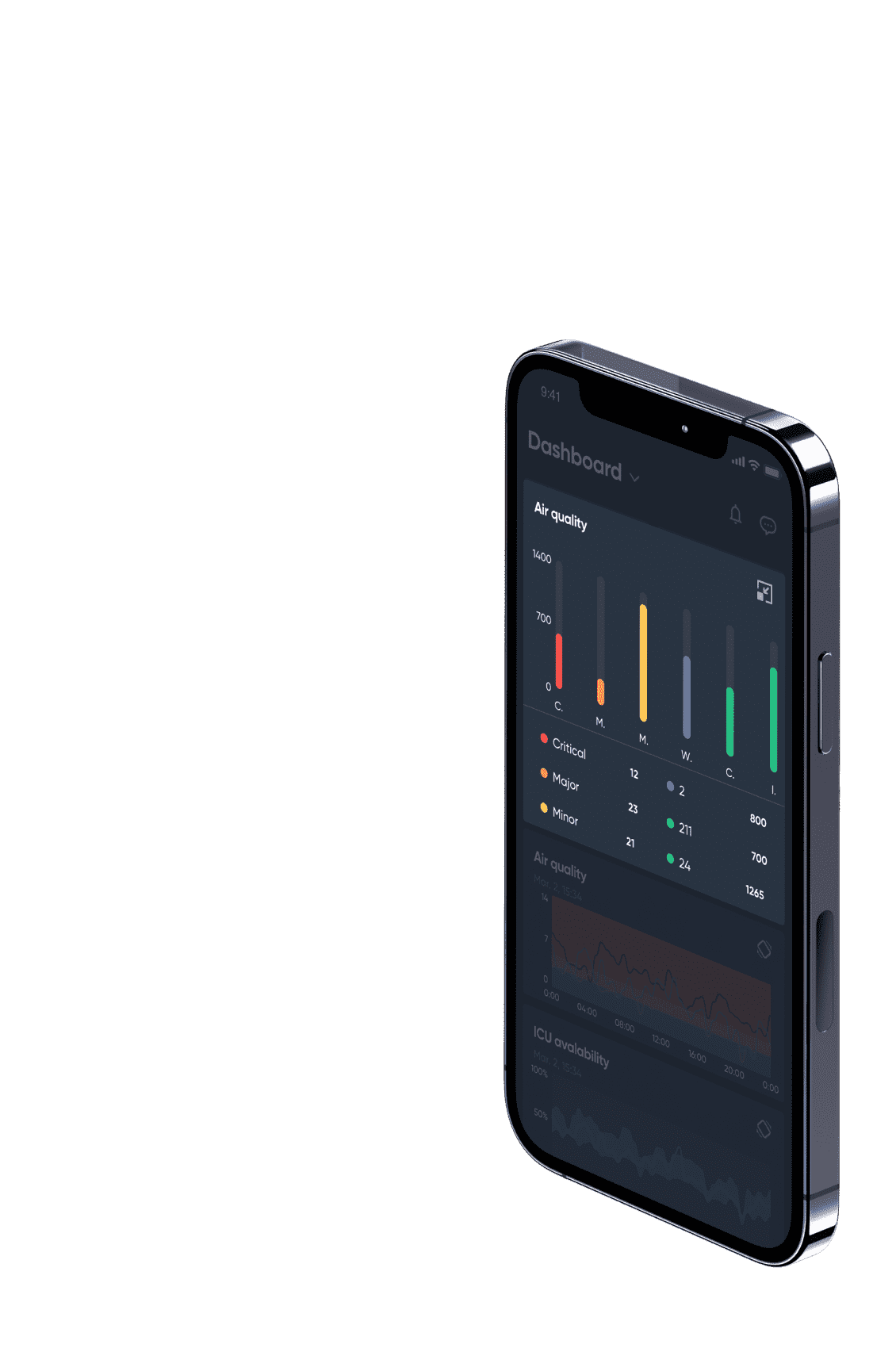
These indicators can be used to track and monitor the progress of the city's operations.
A monitored city becomes friendly, makes life easier for residents, reduces infrastructure degradation and energy consumption. Ultimately, it also lowers pollution rates.
As it allows for an immediate response to incidents, it is also economical because it saves time and natural resources.
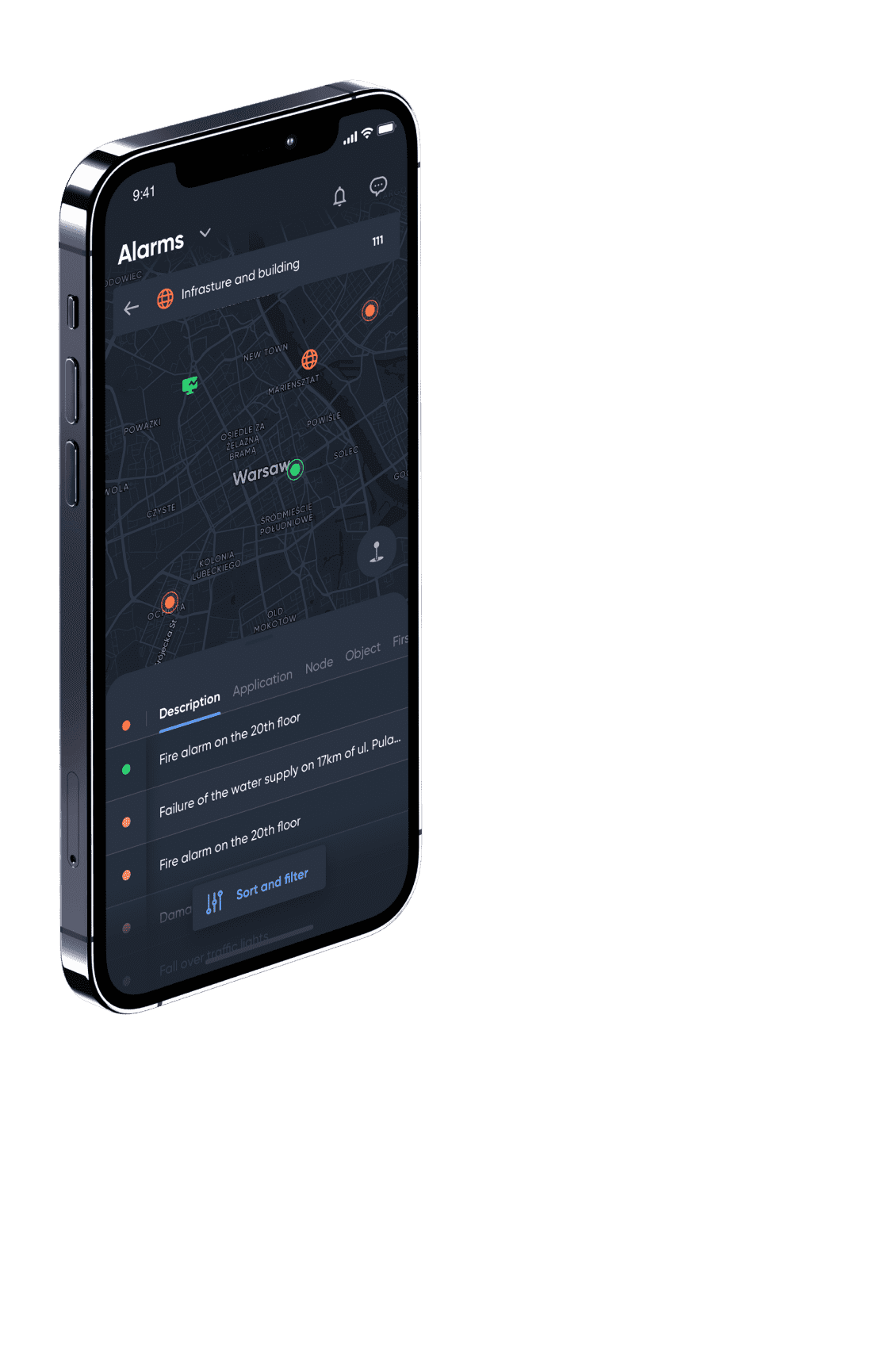
A passerby notices a lack of paving stones on the street, making part of the sidewalk inaccessible. They also spot that a nearby street lamp isn’t working, which could lead to an accident after dark. Through the mobile app, the resident reports the situation and sends a photo. The city's road and maintenance authority receives the report in real time and sends a team to repair the damage.
A property owner is looking to convert the status of his building in the land register. He needs to go to the relevant office, submit the appropriate application, and pay the fees. In the meantime, the legislature introduces new rules, communication with the administrative department drags on, and the owner loses track of the process and the stage that his case has reached. Thanks to the InTrack platform, the entire process is presented graphically, and the property owner is informed about each stage, receiving relevant updates. He can also access these from the mobile app.
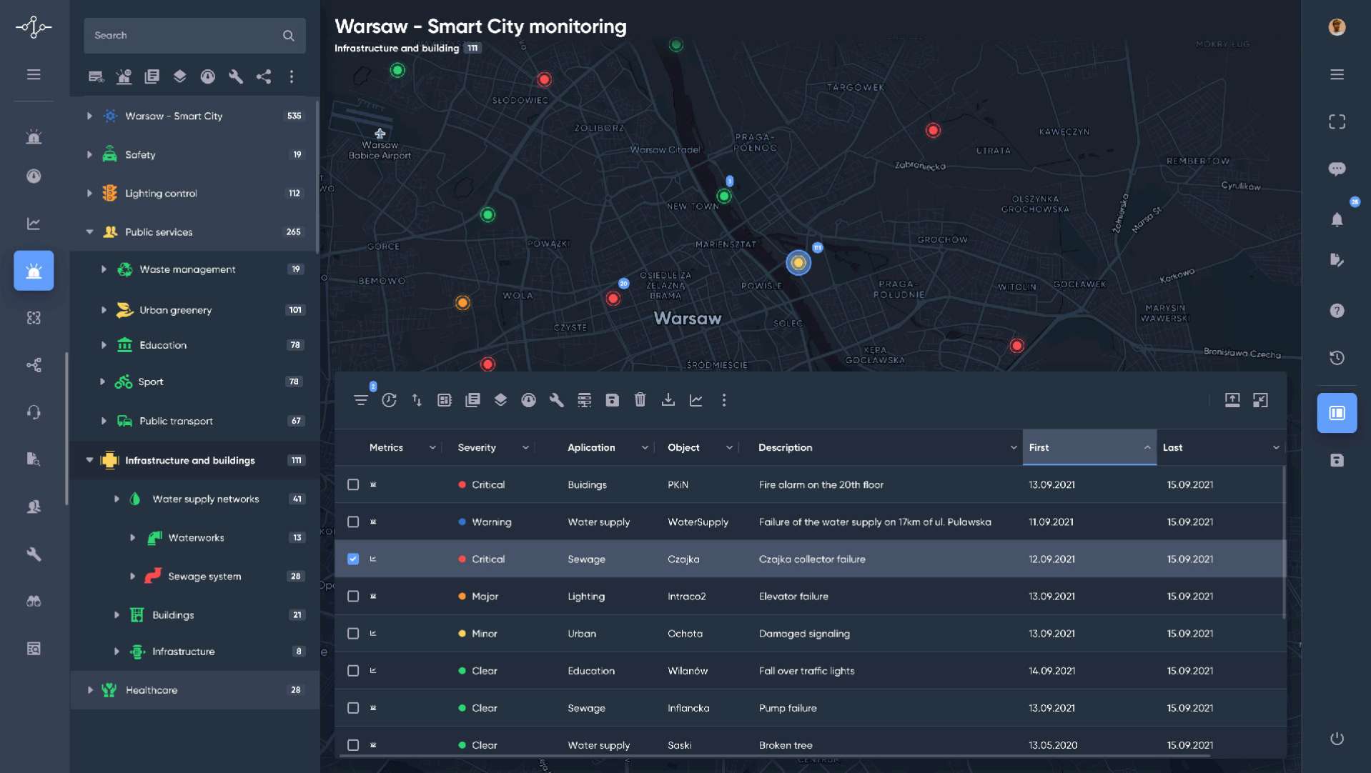
Information about the failure appears in real time. The water and sewage emergency service is able to respond promptly. The data is immediately transmitted to the operators of local traffic lights and public transportation - and the system can automatically set detours and counteract traffic jams in the city. A faster response translates into lower costs related to the price of leaked weter and the elimination of the consequences of flooding.
When the InTrack platform receives information from the Provincial Inspectorate of Environmental Protection (or other reliable sources, such as its own sensors) about exceeded concentrations of particulate matter, it can act immediately. It is able to redirect the information to a safety alert system, so residents receive text messages with a suggestion to stay indoors. Updates about the situation also appear on displays at train stations and bus stops. In super critical cases, owners of cars with a certain type of hyper-polluting engine are asked to leave the zone, or pay a substantial fee for the opportunity to stay within it.
A traffic incident is observed by the city monitoring system. Information about it is sent to an emergency number. Emergency services and the police spring into action, and the system maps out detours. Those closest to the accident receive first aid instructions via text message. Information about obstructions also appears at bus stops.
The emergency number operator receives a notification of the police pursuing a criminal. The system locates the fugitive with the help of monitoring, and responds by switching traffic lights to red. In addition, at the route of the chase, level crossings are closed and information about the chase is displayed on the screens of stations and stops.
Residents receive sticker codes for segregated waste. The garbage collection company weighs the amount of waste from a given address. The scale transmits the data to the system, which verifies that the amount of waste corresponds to the number of residents in the household.
The system can detect an incident involving a specific car. It will automatically detect a car that should not be in the city center zone due to emissions criteria, and will also check whether the owner has paid the necessary tolls.